Map of Piccadilly

Thomas Sulman's 1880 Map of Piccadilly, London.

Map of Piccadilly

A Raven's eye view along Piccadilly.

1880 Map of Piccadilly, London

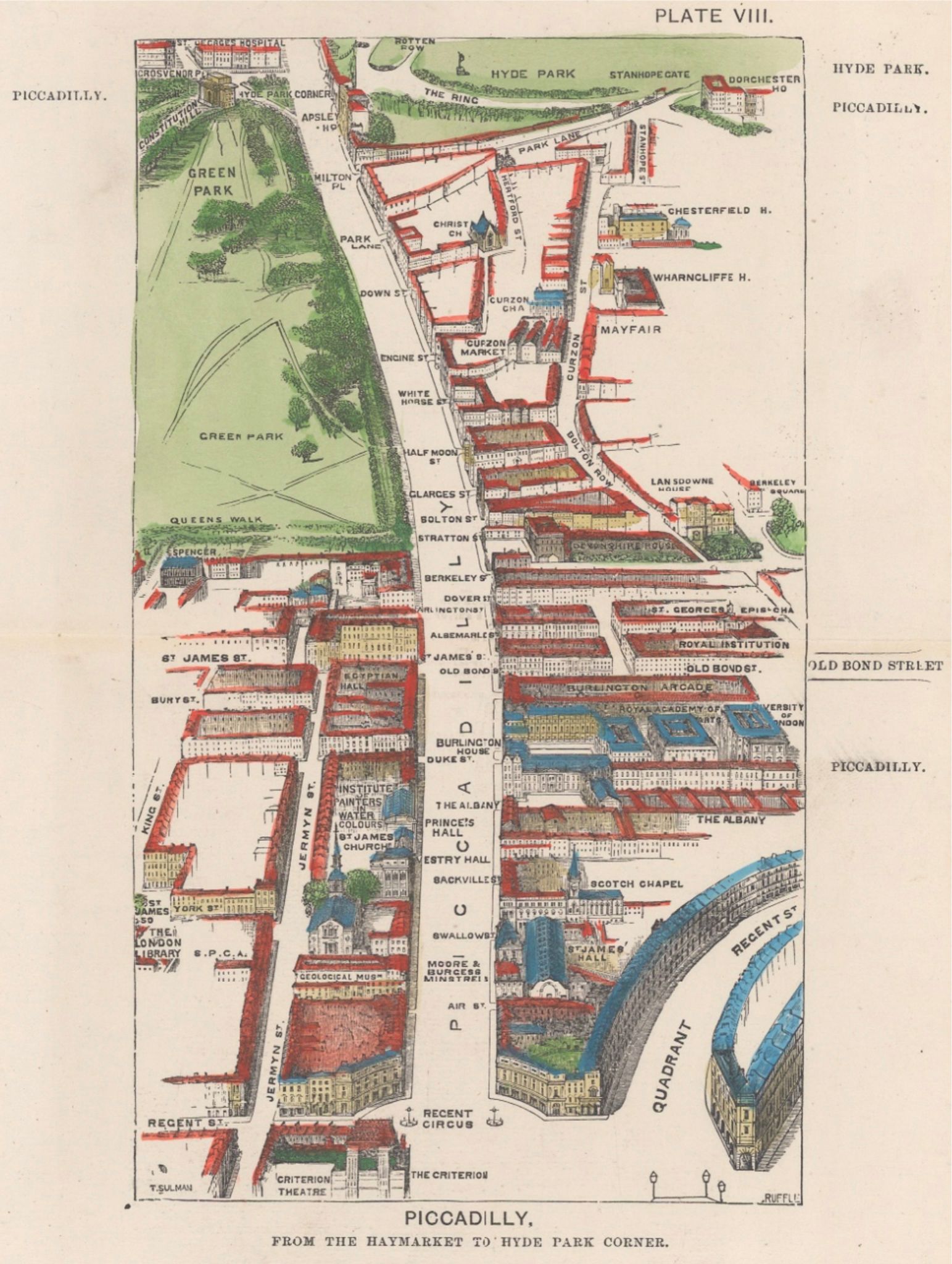
Thomas Sulman's map of Piccadilly from The Haymarket to Hyde Park Corner, 1880. Shows Berkeley Square, Hanover Square, the Royal Academy of the Arts and the clubs along St. James's Street. 7 x 9 inches / 18 x 23 cm. Complete with certificate of authenticity.


To receive a weekly roundup of new posts subscribe here. Any donations go towards funding research, reporting, independant video servers and growing the site. Thank you, Rajesh.

Bitcoin Wallet: 3Dzp87Gz7EhtQpHSYCBTSMN81GMeCQgAtm

Leave a Paypal Tip
Cartography Club - Journal
Atlases, antique globes, celestial models, sea charts, rare maps of voyages. Along with scientific instruments and navigational surveying tools of Cartographers.